|
SNOWMAN TREK SEPTEMBER / OCTOBER 2003
After doing the two-week Jomolhari-Lingshi-Laya Trek in April, we thought that we could tackle the infamous Snowman Trek. For those of you who have the “Lonely Planet” book on Bhutan, it states that “ fewer than half of the people who attempt this trek actually finish it, either because of problems with altitude or heavy snowfall on the high passes”. There is a very short window in which to do this trek due to snow so September / October is considered the best time. There can also be problems getting yaks up in Lunana (the Lunap people are a law unto themselves despite previous arrangements having been made) so it was decided that we should do the trek in reverse and hire animals from Bumthang and start at Dur Village. This worked extremely well although I think that the trek was probably tougher in reverse.
The trek involves more or less 300 kilometres of high altitude walking in three weeks. The map shows the route as a black line looping up from mid-country, through the high-Himalaya and coming down at the head of the Punakha Valley. The loop on the left of the map is the previously mentioned Jomolhari-Lingshi-Laya trek and this takes two weeks. If the whole trek is done in one go a full month is required.
There were five in our group – BartJordans a Dutch mountain guide but only a trekker this time, ourselves and Pat and Baiba Morrow, Bart’s friends from Canada and ourselves Austin & Isabel Hutcheon. They are professional mountaineers and photographers and Pat videoed most of the route – Pat was in the first Canadian expedition to conquer Everest 21 years ago. To his chagrin he was the second Canadian at the summit. We were a bit worried that we would not be able to keep up with the others who were at least ten years younger than us – but it all worked out well. On Saturday 20 September we went by minibus to Bumthang – this usually takes us seven and a half hours but this time we took twelve hours. The driver was extra careful (we nearly took over the wheel as he seemed incapable of changing down gear until the last possible moment!) and also we were stopped for one hour by a landslide which had only just happened – rocks still falling – outside Wangdue. |
|
Fortunately there was a road-camp not too far away and an earth-mover trundled along to help clear the debris. We met up with some friends at the Swiss Guest House in Bumthang in the evening – they were doing the cultural things. |

|
Next day – Day 1 – we drove up past Kurjey Lakhang to meet our eighteen horses, guide, cook, etc at Dur village. We set off at 09.30 and within minutes we were knee-deep in mud as there had been rain for two days previously – all thoughts of trying to keep clean soon vanished and that was the philosophy for the rest of the trek! We passed one possible camp-site at Gorsum but plodded on as we seemed to be maintaining a reasonable pace. At 2.30 we reached our camp-site at Chopchumey (3251m); it was difficult to find a dry place to pitch the tents but at least the crew were able to set up the kitchen in a yak-herders’ shelter (usually we had a kitchen tent and a mess tent but there was no dry area to do this).
Day 2 dawned with beautiful sunshine so we made an early start – the path was still mucky but not as muddy; this was a harder day with lots of climbing and bridges to cross. We camped at Tsochenchen (3947m), a lovely site by the river – we even dared to wash in the glacial water! Nearby there was a yak-herders’ village where we changed our horses for yaks next day as we were going up higher. These animals are quite a sight when they are saddled – on the whole they are docile animals but it is not advisable to get too close to their massive horns.
Day 3 was mostly uphill unfortunately - first we climbed up steeply to Jule La (4639m) – “la” means “pass” – which took us three hours; we then descended to a lake before climbing up to Gokhong La (4327m). Then ensued a horrendous descent of over 1,000 metres to Dur Hot Springs where we were to camp and spend a rest-day. Grass had to be scythed before we could pitch tents. The two wooden huts were already occupied by Bhutanese who had come up “en famille” and brought along grand-father to take the waters. I should think that he felt worse when he got home after walking 3 to 4 days in each direction! These springs are far less frequented than Gasa which is only a day’s walk from a main road. At Dur there are five springs – each with a wooden tub and rough shelter. It was great to be able to soak in these to ease aching limbs. |
|
Yak in all its splendour |
Dur Hot Springs - temperature test |
Two Bhutanese in lively discussion |


|
Day 4 was spent catching up on laundry, bathing in the springs and generally being lazy. We also interviewed the caretaker of the springs (our guide translated as my Dzongkha is not quite up to that!). He had many stories to tell about being at Gangkar Puensum base-camp with a British expedition, royal visits to the springs, etc. When given a picture, he had difficulty seeing it and when given a pair of old spectacles which suited he remarked that “it’s like the sun rising” as he had suddenly been able to see everything so much more clearly. We obviously did some good on our travels! The caretakers wife and daughters were up in the mountains with his yaks – the girls had never been to school and he had never let them go down the valley to Trongsa in case they married someone from there! If any one has access to the “Lonely Planet” the route is covered to date as the Dur Hot Springs Trek. For the next three days we trekked across to meet the path coming from Lunana – this is not in “Lonely Planet”. Our first six days were the toughest way to start the Snowman Trek. It is more usual to start or end at Nikka Chhu between Trongsa and Bumthang.
On Day 5 we started early as usual, walked beside and crossed the Mangde Chhu, then climbed and climbed and cl……. up to Nelu La (4560m). Our luck was out as the rain started and poured for the rest of the day. Our camp-site at Wurthang (4530m) was in cloud and miserable – while we waited for the yaks to arrive, we were invited into a yak-herder’s house and given hot yak milk to drink – delicious! We all smelt like kippers when we came out as they cook over a fire and there are no proper smoke outlets. They had lots of “datsi” – soft yak cheese. Some of the bigger cheeses were sitting above the fire to be smoked. They also have very small hard cheese sold in strings (“chugo”) almost impossible to chew without breaking one’s teeth. We spent a miserable night there and set out at 7.20 on Day 6. With alternating sleet and sun we climbed to Wurthang La (4780m), descended to some lakes, climbed up to Saga La (some snow at 4854m), came down to Phobdrang where we lunched in an empty hut. We decided to carry on for two hours over Phobdrang La (4652m) then had a difficult descent with lots of boulders, a land-slide and no clear path to camp at Minchirang (4256m) by the Sacha Chhu – and the rain was still lashing.
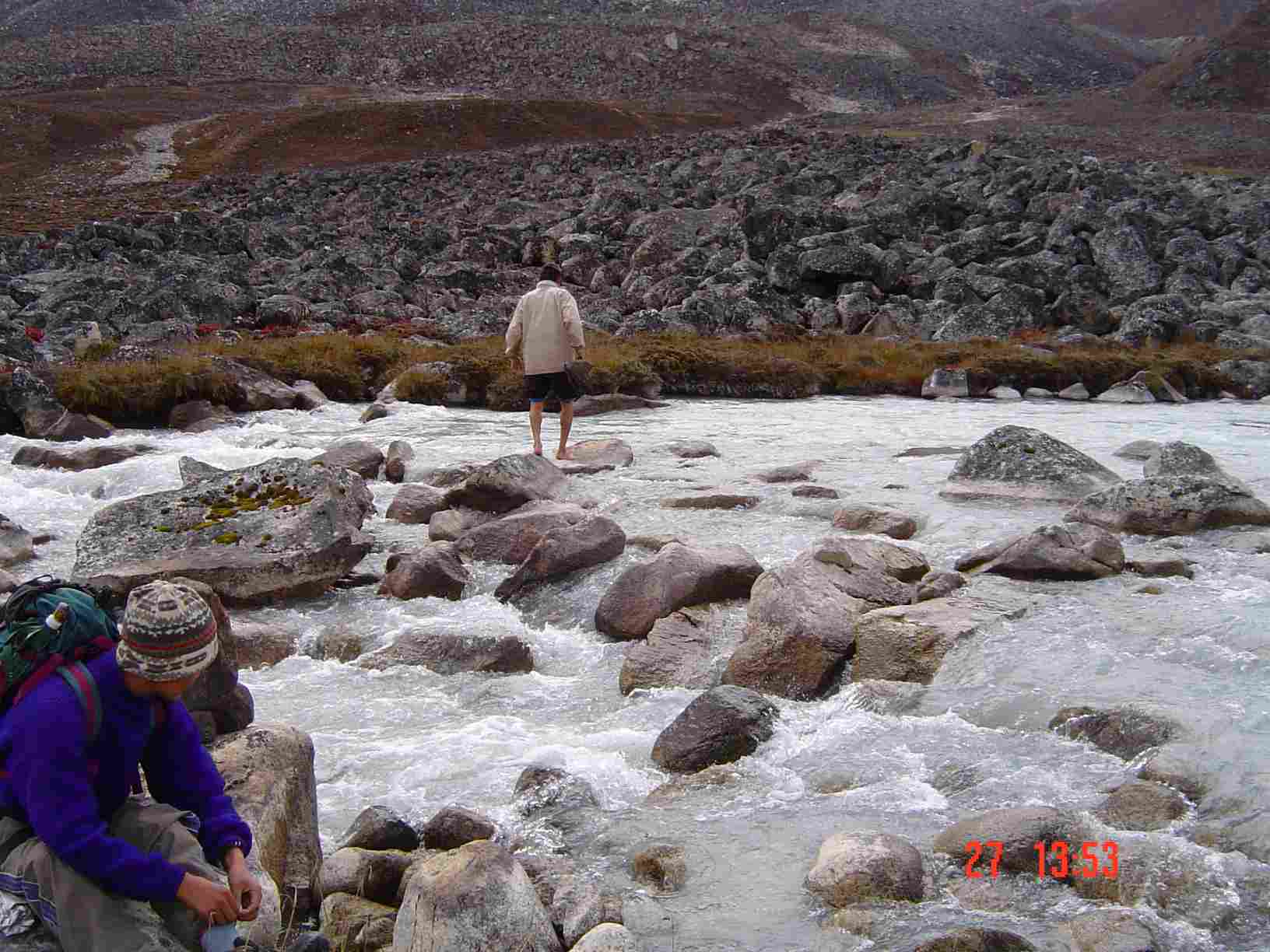
Day 7 favoured us with sunny weather; we walked up a long, long valley passing a few yak-herders’ huts – they said they had lost seven young yaks to snow leopards and they reckoned there could be five in the area. We looked carefully but saw none! We had a superb view of the Gangkar Puensum range. At the end of the day we had to cross a large river over which there was no bridge – we all stripped own to our underwear in the nether regions and were all helped across by the trek crew – some of us more unceremoniously than others as a certain amount of pushing over rocks was required. At least in camp at Zanam (4962m) we were able to dry things out. |
|
Scary Landslip Slope |
The Icy River Crossing |
Top of the World - above the clouds |


|
When we wakened on Day 8 we found a slight covering of snow which soon disappeared. We had a long haul for three and a half hours up the valley to Gophu La (5476m) with excellent views of Gangkar Phuensum (see left) and glacial moraines. On the way Baiba started to feel the effects of altitude and had slowed considerably, even vomiting twice. She carried on and improved once we started to get to a lower altitude fortunately. Isabel plodded on over the pass and down to a lake, but by the time we had a late lunch at 1.00, she felt absolutely shattered and wondered what she was doing there – we all had bad days. Recovery set-in after lunch and we carried on for one and a half hours to camp in the valley (4987m) just short of the turn-off towards Nikka Chhu – we had all had enough that day! Day 9 was much easier fortunately – walking down the valley (with one yak fewer as it had injured its leg up in the mountains – it was to be collected by the yakmen on their return); there was a short climb up to overlook the Pho Chhu where we lunched. We had an excellent view of the GLOF (glacial lake outburst flood) damage – this happened when a glacial terminal moraine above Raphstreng Tsho burst in 1996, water poured down the Pho Chhu drowning 23 people, causing untold damage to houses and fields and eventually reaching Punakha where it destroyed a large part of the historic Dzong. The channel gouged out by the GLOF can be seen above right. As you can imagine, Austin literally had a “field” day here! It was then a short descent to the camp-site at Tenchhu (4147m) with Singye Gang towering above the glacial lakes. There are two other small villages nearby called Tanza and Duta and all are relatively prosperous due to yak plus some crops (potato) are grown. This is the start of the Lunana region and we said good-bye to our yaks here. For the rest of the trek we used horses which go slightly faster. We were obviously a source of great amusement to the local children, very few of whom seemed to go to school in the next village, Lhedi – more of that anon. It gave me a chance to use my Dzongkha and teach them a few words of English – they loved this and it seemed a shame that they did not go to school. |
We were invited into a
typical Lunap farm-house, sat round the fire, ate yak cheese and generally
gleaned information about the area, weather, etc – all very cosy. So far we
had encountered no other trekkers at all.
The GLOF erosion channel at Lunana |

|
Day 10 was a rest-day so we all walked up to Thanza where there is a radio station with two operators in constant contact with Thimphu over the situation of the glacial lakes – they are worried that Raphstreng Tsho (“tsho” means “lake”) and one above might burst too. A group of Japanese glaciologists had just made the four-hour climb to the lakes to camp there for a month’s work – we decided to give that a miss! That particular day was an auspicious one and there were “pujas” (religious ceremonies) everywhere in honour of the mountain deities. We thought that a change in the menu was in order that day – meals had been good so far but we really had had enough rice! – so tuna pie was concocted and snapped up.
Day 11 brought a pleasant walk of five and half hours down the the Pho Chhu valley passing through what looked like sand-dunes – all caused by the aforesaid GLOF flood. We passed Chozo village where there are some “gomchens” (lay monks who are allowed to marry) at the Dzong. We had glimpses of Zongophu Gang, also known as Table Mountain because of it shape. We camped at Lhedi (3768m) which is the “central” village in Lunana although it has only about eight houses. It has a Community School founded in 1997, a Renewable Natural Resources office and a Basic Health Unit (BHU). We walked along to speak to the government staff as in the main they do not like such remote postings and welcome the chance of conversation. Austin spoke to the RNR chap who felt completely let down by the administration in Bumthang and Thimphu who never visited or gave support (this was also the case in Gasa, Lingshi and other remote places we have visited). The young man in the BHU had a punishing schedule visiting even more remote villages once a month. At the school Isabel spoke to one of the two teachers – he had been there only one week but had opted to transfer there from Gasa. The school is open only from 1 May until 31 October because of snow – teachers go back to Gasa or Thimphu as do the other civil servants. There were 33 children in the school only up to Class 4. When I asked if they transferred to Gasa after that, he said no children had gone that far. The Lunaps prefer to make their children (daughters in particular) look after the yaks and it will take something drastic to change this view as this is their livelihood. A lecturer at the National Institute of Education in Paro (who incidentally has been nowhere near those remote areas like most of the Bhutanese in Thimphu and Paro!) was suggesting having “mobile schools” which might be the answer (“mobile” meaning following the yaks to the high pastures!). He said there were lots of volunteers but I am not so sure of that as Lunana lost both of its teachers last year. There was also an important archery match in progress – best ghos worn, and all with compound, imported bows; these yak-herders are not short of a ngultrum or two!
Austin had a bad day on Day 12 when he seemed to run out of steam – even Pat did later in the trek - however with Rabten (one of the crew) carrying his back-pack, he made it along the river to the gup’s (local official) house at Thega, then on to a pleasant meadow for an early lunch (we learned from previous experience!) and on up and over Keche La (4656m). There followed a descent, up again to Laptsha and a long descent to the river, across a bridge and then a final one-hour slog through the forest to the camp-site at Woche (3934m). We had quite a social gathering there as we met trekkers coming the other way – they turned out to be none other than fellow DANIDA adviser, Piet van der Poel (who is normally based in Trashiyangtse). Bart spent the evening trying to negotiate with the gup for two porters as he was taking a precipitous route down next day from Woche to Tashithang – he had an American tour group to lead four days later. Yaks and horses do not normally take that route as it is too steep. He eventually succeeded after 36 hours of negotiation – as mentioned before, Lunaps are a law unto themselves. We heard later that he had eventually done the route in two 11-hour days whereas it normally takes three days. |
| On Day 13 we left the Lunana region and had a pleasant walk along the upper reaches of the Pho Chhu passing about five very fearsome land-slides on the way. At the foot of two were a couple of huge granite boulders that one could not believe could have traveled so far – we were just glad that we were not around when it happened. We camped in the flat valley 90 minutes beyond Tarina (4114m). There was already a camp there – a base-camp for nine Japanese climbers who had another camp four hours further up so we did not meet them; they were in the area for about one month and climbing beyond the impressive glacier on Terigang which towered above the camp. We were told by their PR man (who had done the same climb 15 years previously) that they were allowed to climb no higher than 6,000 metres – we wondered who was going to check! We were glad it had been an easy day as we had been warned that day 14 was would be “very hard” and uphill for most of the day. |
|
Day 14 saw us set off at 7.30 all psyched up to make a supreme effort. It seemed to work. Baiba progressed slowly but surely and did not seem to suffer the effects of altitude this time. Austin and Isabel could not believe how well they did – just stomped on, stopping rarely on the notoriously dreadful trail with rhododendron roots and slippery mud, past impressive lateral and terminal moraines (geology from student days suddenly came to life!), past lakes over which towered mighty Ganga Karchung, Jejekangkha Gang and Tsenda Kang ( “kang” and “gang” are short for “gangri” meaning mountain) until five and a half hours later we crossed Karchung La (5231m) – over 1,000 metres higher than we had started. Isabel was surprised to be first at the pass – I do not think our guide could believe it either! Psychologically it did so much good to be in front for a change. The horses had carried on further than we thought and we finally caught up with them beyond Narethang (4932m) – quite a high camp again. |

|
On Day 15 we awoke to find a fair amount of snow had fallen – there were glorious views of mountains, glaciers, moraines, etc – a photographer’s heaven. We did not set off until 8.00 as ten horses had decided to de-camp overnight. They were eventually rounded up by the horseman and this was to happen once more. Goodness knows why they don’t hobble them – perhaps because of wild animals – then again the sound of horse-bells going all night does not make for a perfect sleep! We took things very easily and stopped frequently after the previous day’s efforts. There was a climb up to Tsomo La (4741m) but for once it was level walking after that before a rocky, steep descent to the camp-site at Rodophu (4294m). We saw two other groups camping in the valley. There was a couple of men who arrived just after us and a group of seven Germans who arrived at 4.00 and than had to wait for two hours for their horses and tents to arrive! They were going in the opposite direction and were very interested in knowing about the condition of the passes. I fear that they may have had a lot more snow than we had – we heard later that one of Piet’s tents had collapsed under the weight of snow.
Day 16 saw an early start; we crossed the river and had a easy walk through conifers, across another land-slide, over a pass with no name, lunched at a point overlooking Gasa Chhu and then had a fairly tortuous descent to join the path coming up from Koina to Laya. Here, much to our dismay, we had to go uphill (in the wrong direction!) to the camp-site just below the Indian Army check-post about 90 minutes from Laya (3465m) where our permits were checked. Austin and Isabel felt almost on home-ground having passed that way on our way back from the Laya-Lingshi Trek in April. A group of six Americans passed through later in the day on their way to Laya. |
|
On Day 17 we bade farewell to Pat and Baiba who were continuing for another week to Laya, Lingshi and Jomolhari (which we had already done). We spent a lazy, rather cold day in camp with no-one passing through. We had some excitement in the evening when it was discovered that one of our mules (we were down to five horses for the two of us) had eaten a poisonous plant called monkweed. The remedy was for the horseman and cook to pour sugar solution from a Coke bottle down its throat to make it vomit – that took some effort. It seemed to succeed as the animal survived, although it could not carry anything next day – the horseman had to! Day 18 saw us on familiar ground – a nice, easy walk down the banks of the Mho Chhu crossing bridges and passing a cave formed by an overhanging rock. The path now seemed to go into a canyon and did a series of ups and downs – in spring we had managed to walk by the river and cross a bridge, but this had been washed away by the monsoon rains. We climbed up to Kohi Lapcha (3300m) before turning into a side valley and dropping down to Koina (3050m) where we were to spend the night. We were dreading this as it is described as “a muddy bog in the forest by a bridge”. When we last passed through, our guide would not let us stay in the house there, as he said it was frequented by drunken yak-herders so we then continued for two hours to a sodden camp-site. |
The camp site for the rest day near the Indian Army Check -Post |
This time we stopped at the house where there was a caretaker – and very glad we were that we did! The rain poured for the rest of the day and we felt snug and warm inside. We had a choice of three rooms with two rudimentary beds, a table and two chairs which we opted for. Cooking was done in the large central area and there was even solar lighting – it seemed like a five-star hotel in comparison with a soggy tent! One American woman arrived with her entourage and some horsemen with Army supplies turned up – we spent a very sociable evening and everything was dry! Not so on Day 19 when the rain continued incessantly and we had a very wet walk – in theory it should be downhill to Gasa but the first part is uphill all the way to Bari La (3900m) before descending steeply for about three hours. Gasa Dzong can be seen on the opposite side of a large wooded side valley – it took about one hour to reach it, rather like the road approach to Trongsa Dzong – a real sting in the tail! On the way down we met lots of local people on their way up to Laya. Gasa Tsechu (religious festival) had just ended so dancers, civil servants, etc (some having imbibed too much “arra”, the local spirit) were wending their way home. |

|
Gasa town was a muddy mess, but we left the cook erecting the tents on the field (more like a swimming-pool) and tried to find a telephone – the first place on the trek to have telephone access. We had rung from there in April but when we tried to do so this time, it seemed that the local population had turned into imbeciles as they professed to know nothing about a telephone – perhaps it was “be nasty to trekkers’ week”! We eventually found a switched-on shopkeeper and made telephone calls to home and the office to ensure that transport would meet us next day. We even splashed out on a beer – our first for three weeks. We would have had another one later but we could not face “swimming over” from the camp-site again. We passed a very wet night, kept awake by the local dogs (the first we had had on the trek). Three Americans arrived very late to camp beside us – they were hoping to go up to Masang Gang Base Camp and back – I wonder if they made it, as they were asking us if it was much colder up there and I heard them ask each other what they were going to do with their wet, dirty clothes – there is only one answer to that: “Wash them in the river then walk with them hanging from your day-pack”. They appeared in the morning with immaculately clean trousers on – I can guess that they definitely had TWO SETS of dirty clothes by that evening!
Day 20 – our last day! – should have been easier although it was a long way. We had done most of it two times already, but it seemed to take forever – I guess that we were more tired than we realised. Also we met a number of people on the way including two large groups of French tourists who had 35 horses all together. It took quite a long time to let them pass! I doubt that they really believed that “two old bufties” had already completed the Snowman Trek. We stopped for lunch and then bought a cold drink (bliss!) at Damji before tackling the last hour down. Driver and car were waiting as arranged at Kabina and the horses had arrived before us, so we gratefully let ourselves be driven for the last three and a half hours back to Thimphu.
The Snowman Trek was tough, but we are really glad that we succeeded in doing it. The trekking crew said their parents were younger than us but would never do the trek as they were too old! We were certainly fortunate with the weather so we cannot take all the credit. Austin plotted all the trek on his GPS to down-load on to the computer and a monster map was produced and hangs in the Bhutan Soil Survey office in Simtokha and at home. Pat sent us a shortened version of his video and we watch that when we have withdrawal symptoms. |